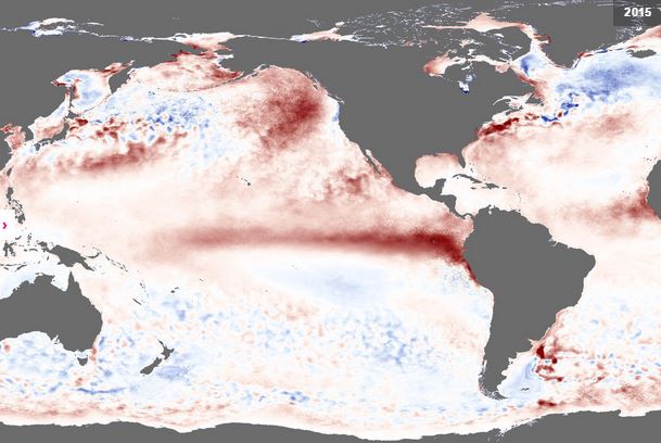
The current El Niño event affecting the Pacific has an 80
percent chance of lasting into early spring 2016, according to an updated
forecast released on Thursday by the National Oceanic Atmospheric Adminisration
(NOAA). NOAA also reported that there is a greater than 90 percent chance of El
Niño lasting right through the upcoming winter.
El Niño is an anomalous, yet periodic, warming of the
central and eastern equatorial Pacific Ocean. For reasons still not well
understood, every 2-7 years, this patch of ocean warms for six to 18 months.
The latest forecasts from the Climate Prediction Center
(CPC) in Maryland calls for a strong El Niño event to occur between now and the
coming northern hemisphere winter, which is when El Niño conditions tend to
peak, as well as when they have their greatest influence on global weather
patterns. The International Research Institute for Climate and Society (IRI) at
Columbia University is also forecasting near 100% odds of El Niño conditions
through at least the winter, and forecasters there also say it is likely to be
on the strong side.
Although the El Niño is still officially classified as a
“moderate” strength event, Tony Barnston, one of the world’s leading El Niño
experts, explained it could well become a “strong” event by the end of the
month.
“The strength of the departure from normal sea surface
temperatures was enough to call it a strong event for just last week,”
Barnston, of Columbia’s International Research Institute for Climate and
Society (IRI), said. “But to call it an officially strong event, we need for it
to stay at that level or higher for a full month. And the average for July
could make it.”
El Niño is also being blamed for the early start to the
hurricane season in the Eastern Pacific with Los Cabos already being on the alert
several times. It will be a long season it seems.